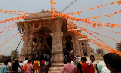
Theft at Ram Temple is betrayal of public trust. Now, Reform
April 8, 2023

|
Getting your Trinity Audio player ready...
|
(The article was originally published by Indian Express on April 8, 2023 as a part of Dr Madhav’s bi-weekly column titled ‘Ram Rajya’. Views expressed are personal.)
“ALL WARFARE is based on deception”, Sun Tzu, the famed Chinese military strategist averred in his treatise. Deception is integral to the Chinese leadership’s machinations.
India has been a victim of this deception from the time of its Independence, which, by a sheer quirk of fate, coincided with the victory of Mao’s Red Army in China. As Indians were revelling in their newly won independence, Mao was sending messages to Indian Communists, promising support in their violent “liberation struggle” to over-throw the government of Jawaharlal Nehru. whom they derided as the “running dog” of imperialists and a “loyal slave” of the enemies of the revolution.
In the early 1950s, China started indulging in cartographic deception, staking claims to large parts of Indian territory. The Indian leadership looked at these claims as a negotiable misunderstanding and complacently trusted Zhou Enlai’s lies. Even while announcing the ill-conceived and ill-fated “forward policy” in October 1962 to assert Indian authority over territories under cartographic challenge, Prime Minister Nehru smugly believed that the Chinese would never attack India. In 1959, he condemned the British Tibetan expert George Patterson for spreading “bazaar rumours about the Chinese” and threatened to expel him.
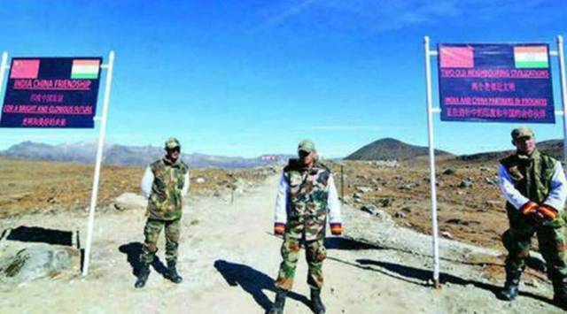
Despite his hollow claims recently in Moscow about standing “guard over the world order based on international law”, President Xi Jinping continues to pursue that old Maoist strategy of violating sovereign national boundaries of neighbours using cartography as a weapon.
The recent rechristening of villages, unpopulated areas, rivers and hills in Arunachal Pradesh by the State Council, the Chinese cabinet, is another example of that cartographic deception. Never in known history did Arunachal Pradesh have any remote contact with China. There was never any Chinese presence there, nor was there any familiarity between the two peoples. Tibetans from Lhasa used to travel to Kolkata via Sikkim and sail onwards to mainland China. At most, the Monas of Tawang spoke Tibetan, but a few miles down the road, the Sherdukpens of Bomdila spoke a different dialect and hundreds of other tribes further to the east spoke languages that were closer to Assamese.
The only time in recent history the Chinese army came close to Arunachal Pradesh’s borders was during the final years of the Qing dynasty in 1910-12, when it entered Kham across what became the MacMahon Line in the Walong area, as part of a campaign to crush the revolt by the Khampas in eastern Ladakh. The Chinese were preoccupied with the raging civil war in the subsequent decades, while the British administration gradually established its influence over the entire northeast frontier tracts – NEFT. After independence, the administration changed into Indian hands and NEFT was renamed as the Northeast Frontier Agency or NEFA in 1954, and Arunachal in 1987.
Some pro-China historians claimed that parts of Western Arunachal Pradesh like Tawang were under the rule of Lhasa before 1950. But historical records negate such claims. Although the sixth Dalai Lama, a Mona, was born in Tawang in 1683 and moved to Lhasa a to become the spiritual and temporal head of Tibet in 1697, Tawang remained largely independent of any outside authority. Through the Shimla Agreement between the British and Tibetan governments in 1914, the McMahon Line became the international boundary between India and Tibet. Tawang fell south of the McMahon Line, clearly putting it out of Tibetan administrative control.
The McMahon Line, branded as a “colonial” imposition by the Chinese, followed the internationally accepted formula of mountain peaks and watersheds as the boundary. Further to the Shimla Agreement, the British had demarcated an inner line that separated the Assam plains from the hills and considered the mountain peaks and watershed areas to its north as the outer line.
People of western NEFA, like their counterparts in the rest of the region, were never subjects of any outside power. They negotiated with the British when the latter made an outreach across the innerline in the early 1900s, and reported to their Commissionerates at Sadiya and Balipara in Assam. After Independence, the cautious Indian administration, led by officers like Nari Rustomji, the ICS official of the Assam cadre, focused on giving primacy to the development of the region rather than exerting authority in haste. But to their surprise, people in NEFA were more keen on some kind of a visible Indian authority over the region and insisted on paying annual house tax so that they could become Indian citizens officially.
When the Chinese invaded Arunachal Pradesh in October 1962, they were extra-cordial with the locals and madespecial efforts to convince them about the greater racial affinity between them. Strict instructions were issued to the Chinese army against harassing the locals. Local people were not forced as porters, nor pressured for any other support. When the airdropped Indian food supplies fell into their hands, the Chinese soldiers used to distribute them among the locals as a “gift” from their government. In spite of all these deceptive manoeuvres during the 49-day-long occupation, the Chinese couldn’t win over the hearts and minds of the people of NEFA. After the war, when Indian officials returned to the region in early 1963, they were pleasantly surprised to see people lining up in village after village to extend a warm welcome.
China continues to call parts of Arunachal Pradesh as Zangnam or South Tibet and makes repeated claims over its territory. The recent renaming exercise is also a continuation of that deceptive claim based on concocted maps. India has dismissed the Sinification exercise, and rightly emphasised that “Arunachal Pradesh is, has been, and will always be an integral and inalienable part of India. Attempts to assign invented names will not alter this reality.”
Yet, India must be alert to this cartographic deception, as it was through a similar deception in 1962 that China annexed territory.

Good piece of contemporary history. Also brings out Nehruvian blunder in not understanding Chinese
Good piece of contemporary history. Nehruvian blunder of misreading chainese well broughtout